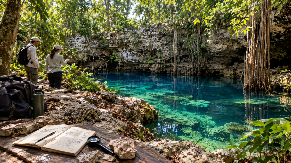
Understanding the landscape through its openings
A photograph of a cenote often concentrates on the water framed by rock. The surrounding ground receives less attention, yet it holds the explanation for the scene. Across Mexico’s Yucatán Peninsula, limestone and underground drainage help create openings through which part of a normally hidden landscape becomes visible. NASA’s account of the region connects its cenotes and caves with rainwater infiltrating soluble limestone. [1] Understanding that connection changes how we read the view.
For readers in the Arab world exploring Latin American geography, cenotes offer a useful starting point. Their interest extends beyond a striking photograph: they make it possible to think about the relationship between the surface and the space below it. This article approaches them through geology and natural heritage. The central idea is simple. A visible pool is only part of the setting, and its appearance cannot explain every underground connection or process.
The meaning of a karst landscape
Geologists use the word karst for landscapes shaped by the dissolution of soluble rock. The US Geological Survey explains that groundwater can dissolve limestone and enlarge spaces within it, creating caves. [2] This is a different way of understanding rock from the everyday assumption that solid ground is an unchanging block. Its structure includes pathways that water can gradually modify.
Imagine looking at the outside of a building without seeing its corridors. You would know the outline but little about movement inside. The comparison is imperfect, since underground passages have no architect or standard plan, but it clarifies the problem. A surface map and a subsurface investigation answer different questions. Knowing where an opening lies does not by itself reveal where its water comes from, how far a passage continues or whether another opening is connected to it.
How water changes limestone
The National Park Service describes how ordinary rainwater acquires carbon dioxide from the atmosphere and soil, becoming slightly acidic. As it travels through soluble rock, it can widen fractures and other openings over long periods. This natural process should not be confused with the separate environmental issue commonly called acid rain. [3] Small pathways can therefore become important features without the rock being carved out in a single event.
The distinction between a process and its visible result is worth remembering. A photograph records the shape present at one moment; it cannot show the full sequence that produced it. Nor should a dramatic opening lead us to assume that all the change was sudden. Some processes gradually prepare the conditions for a later change. Explaining a cenote well means keeping those different timescales in view rather than assigning the whole landscape to one spectacular moment.
Why an opening can appear at the surface
The US Geological Survey distinguishes gradual subsidence from sudden collapse among the ways sinkholes develop. Dissolution below ground can remove support, but the material above and the local conditions influence how the surface responds. [4] That general explanation helps readers understand why similar underground processes need not produce identical surface shapes. It should not be treated as a site-specific assessment of any particular cenote.
For observation, the useful questions concern relationships: how much sky is visible, where the rock wall begins, and how the opening frames the space below. These details provide a vocabulary for describing a scene accurately. They do not establish whether an edge is stable or an unmarked route is suitable. An attractive photograph is evidence of appearance, not an inspection report. Where visits are permitted, designated paths and the site’s instructions should govern movement.
The ring associated with Chicxulub
Some cenotes also contribute to a much larger geological picture. NASA’s Jet Propulsion Laboratory describes a curved alignment of cenotes associated with the buried Chicxulub impact structure. Satellite observations helped reveal a pattern that was difficult to appreciate from ground level, and researchers linked the alignment to fractures around the buried structure. [5] The regional arrangement matters as well as the individual opening.
This offers a clear example of how scale changes understanding. From nearby, attention falls on one rock wall or one patch of water. From farther away, separate points can form an arc. Neither view replaces the other. The close view supplies detail, while the regional view exposes a relationship between locations. It would be misleading to describe every cenote as a separate impact crater; the ring concerns an arrangement within a broader geological setting.
Mineral formations record another process
In limestone caves, water can also deposit minerals. The National Park Service distinguishes stalactites hanging from ceilings, stalagmites building upward from floors, and columns formed where the two meet. [6] These are general cave features, not a checklist guaranteed at every cenote. Their presence introduces a second idea: water can leave mineral material behind as well as remove it from rock.
This makes careful descriptions more valuable than broad promises. A reader should not expect every opening to contain the same shapes, nor infer the age of a formation merely from its size. At a permitted observation point, a useful photograph might show the relationship between a ceiling and the space beneath it. Detail is meaningful when its context remains visible. A close crop alone may make a small feature appear monumental or hide where it belongs.
Natural heritage requires restraint
The Ramsar Sites Information Service describes the Anillo de Cenotes as a complex water system and notes its role as a resting area for migrating waterfowl. [7] That ecological perspective adds another reason to look beyond the pool itself. A natural site may matter because of the processes and habitats it supports, including functions that are not obvious during a
For visitors and photographers, restraint is part of good observation. Leave rocks and plants where they are, avoid disturbing animals, and follow local access instructions. Cave formations deserve particular care: the National Park Service warns that fragile examples can be damaged by touch and that their development spans very long periods. [8] An educational visit does not require collecting an object or reaching an unmarked corner. Notes and photographs can preserve a memory without altering the place.
A clearer way to see Yucatán
Cenotes bring several scales of geography into one subject: the rock surface, the underground passage and the regional pattern. Their beauty becomes more interesting when those scales remain connected. For an attentive reader, the best question is therefore not simply which photograph looks most impressive. It is what the visible scene helps explain, and what still requires investigation. That approach offers a thoughtful introduction to Yucatán while respecting the complexity of the landscape beneath it.
Sources
[1] NASA — Limestone and the Yucatán landscape
[2] US Geological Survey — Understanding karst
[3] National Park Service — Caves and aquifers
[4] US Geological Survey — Sinkhole formation
[5] NASA JPL — Surface clues to buried Chicxulub
[6] National Park Service — Types of cave formations
[7] Ramsar — Anillo de Cenotes entry in the Mexico summary
[8] National Park Service — Fragile cave formations